AEC Knowledge Base Articles
7 Signs Staff Augmentation Could Work for You
Our high-performance staff augmentation service provides committed resources throughout every project. Meet demand, level up, and promote success.
Adaptive Reuse: Keys to Renovation Success
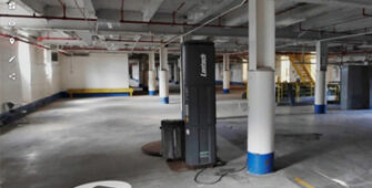
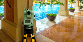
Our reality capture process combines technologies like laser scanning, drone surveys, and indoor mapping to efficiently document existing conditions.
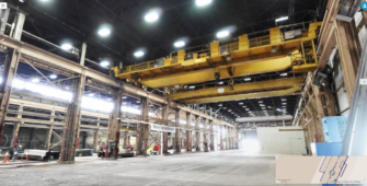
Building Scans & Modeling for Industrial Projects
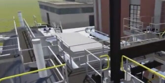
With production data now available for the asking, engineers use digital-twins of facilities to optimize, streamline, and improve manufacturing efficiency.

Document Management Services Now Available
Coast 2 Coast and archSCAN partners to focus on solving maintenance, sustainability, and compliance issues for facility managers.

Top 3 Benefits of New Asbuilts Drawings During Hotel Renovations
Our survey process helps our Architects, Designers, and REIT clients with accurate asbuilt documentation to reduce hotel renovation duration and cost.

19 Functions of Indoor Facility Mapping
Create a “digital twin” of facilities by quickly mapping and measuring spaces while integrating data from other sources.
Top 5 Reasons for Architects to use an As-Built Survey Provider to Doc...
A new survey will give you as-built plans that are up-to-date and without bias. Better details and the latest tech helps you avoid construction surprises.
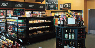
C-Store Updates Expedited with AsBuilt Surveys
The key to getting more for your money during renovation is attention to detail. Existing condition documents ensure nothing gets missed.
360 Indoor Mapping for Warehouse Planning
Indoor mapping is a fast, simple way for leasing, space planning, asset management, maintenance tracking, and tenant build-out in industrial warehouses.

Asbuilt Data: Developers use IoT to Align Inventory & Expectation...
Market expectations for integrated connectivity, urban design, and adaptive re-use challenge developers to plan renovations with tech and walkability in mind.