AEC Knowledge Base Articles
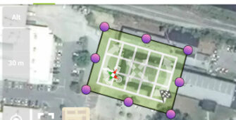
How it Works: Coast 2 Coast AIM Technical Surveys
As a proven partner in the AEC industry, Coast 2 Coast makes it easy to complete your drone survey projects. FAA certified pilots – no step gets missed.
Unique Approach for Unique Projects
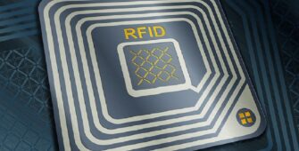
Coast 2 Coast Uses LxCAM’s RFID Technology for Asset Tracking and Secu...
By pairing facility models and documentation with the supplier’s RFID technology, we solve the client’s business problems with total facility solutions.
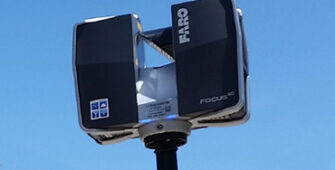
Expanded Laser Scanning Capabilities
Coast 2 Coast is expanding its fleet of laser technology by adding a new tool to its repertoire: the FARO Focus3d, a small, lightweight laser scanner.
Supporting BIM Integration in Healthcare Projects
A field team equipped for complex spaces, systems to handle petabytes of data, SMEs for discipline coordination, our goal is to offset hurdles of adopting BIM.

Company opens green design data center
The teams focused their efforts on a few of the highest-value S&OP levers in order to review the current planning process

Design breakthrough upgrades product
The teams focused their efforts on a few of the highest-value S&OP levers in order to review the current planning process

Parker scalloped blade design
When your focus is preventing you from seeing anything but the problem, meditations which relax your mind and guide you to finding solutions…

Rethinking Hospital and Clinic Design
Healthcare design trends developed slowly in the past. With the recent pandemic, the top 7 healthcare redesign goals today are focused on what to change now.
A Look Toward 2023: 5 Considerations for AEC Firm Leaders and How to L...
Our high-performance staff augmentation service provides committed resources throughout every project. Meet demand, level up, and promote success.